Northeast Insulae Project
at Hippos of the Decapolis (Sussita)
  • Home
  • ArchLit
  • Reports
    • Plans
    • 2002 Season
    • 2003 Season
    • 2004 Season
    • 2005 Season
    • 2006 Season
    • 2007 Season
    • 2008 Season
    • 2009 Season
    • 2010 Season
    • 2011 Season
    • 2012 Season
    • 2013 Season
    • 2014 Season
    • 2015 Season
    • 2016 Season
    • 2019 Season
    • Final Report on the Northeast Insulae Project
  • Publications
  • Galleries
    • Field Photos
    • Finds
    • Teams
  • Repositories
    • Digital Commons
    • Academia.edu
  • Blog

Research Phase/ Sabbatical

Finalizing the model

Mark Schuler (administrator) August 13, 2021

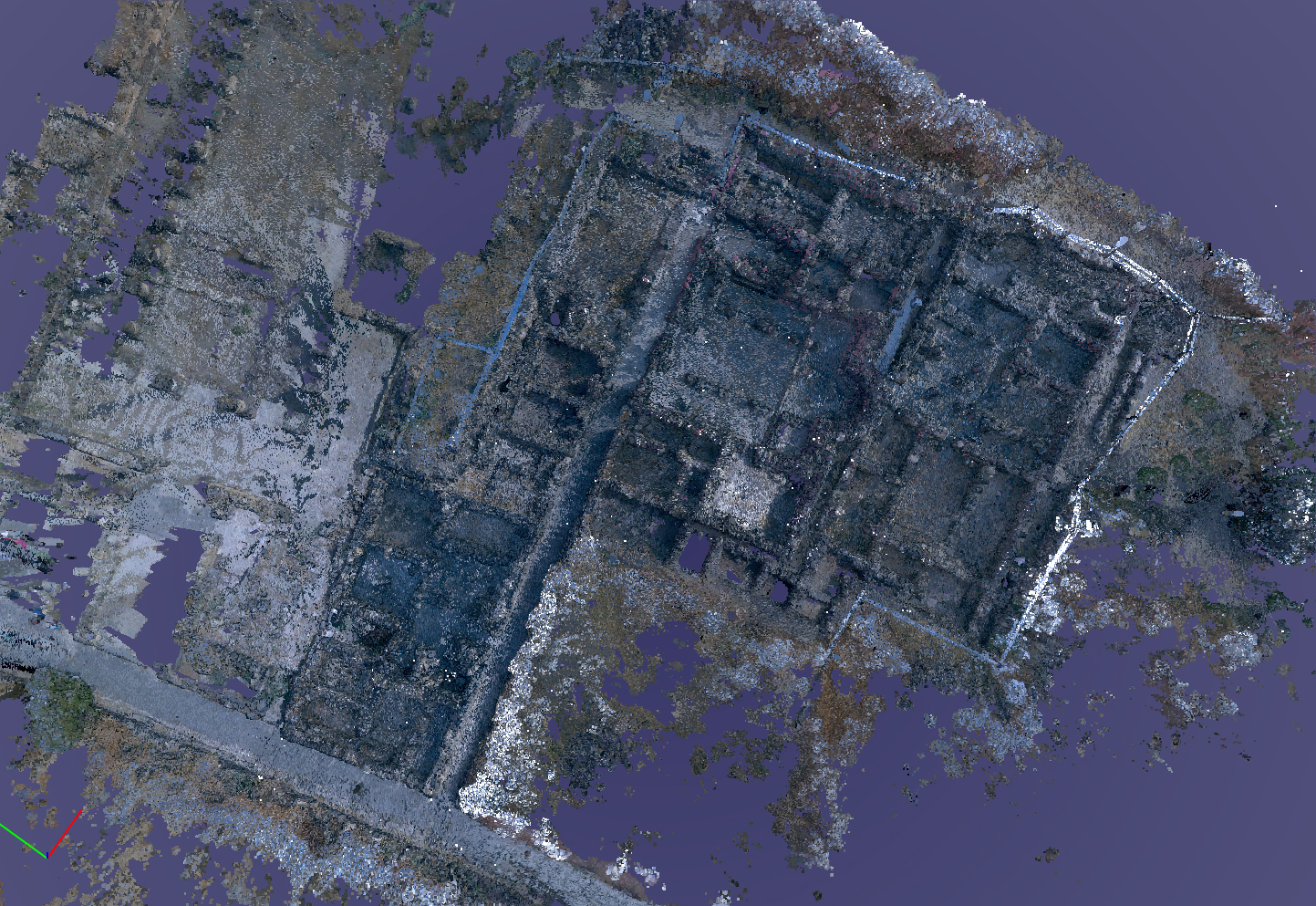
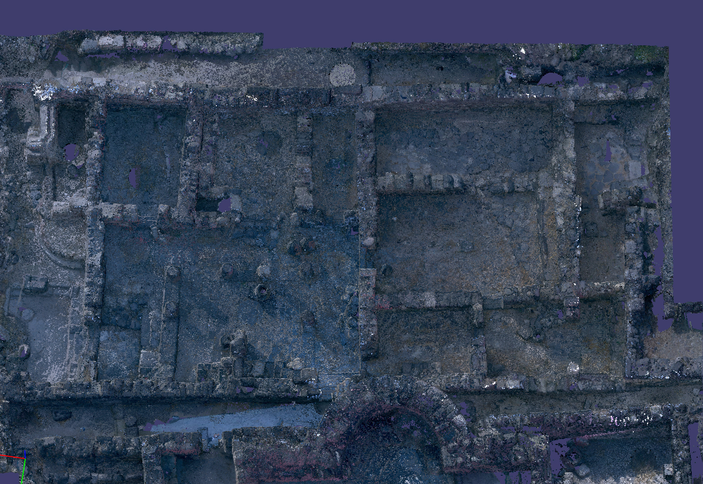
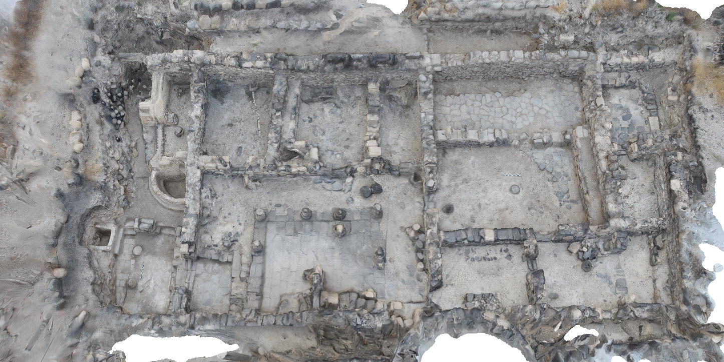
After several weeks of writing, I have this week focused on moving the lidar-based model into a final form. The first finalized iteration includes the entire point cloud and show the northeast insulae in the context of surrounding features.

NIP in context
NIP with basilica to the west.

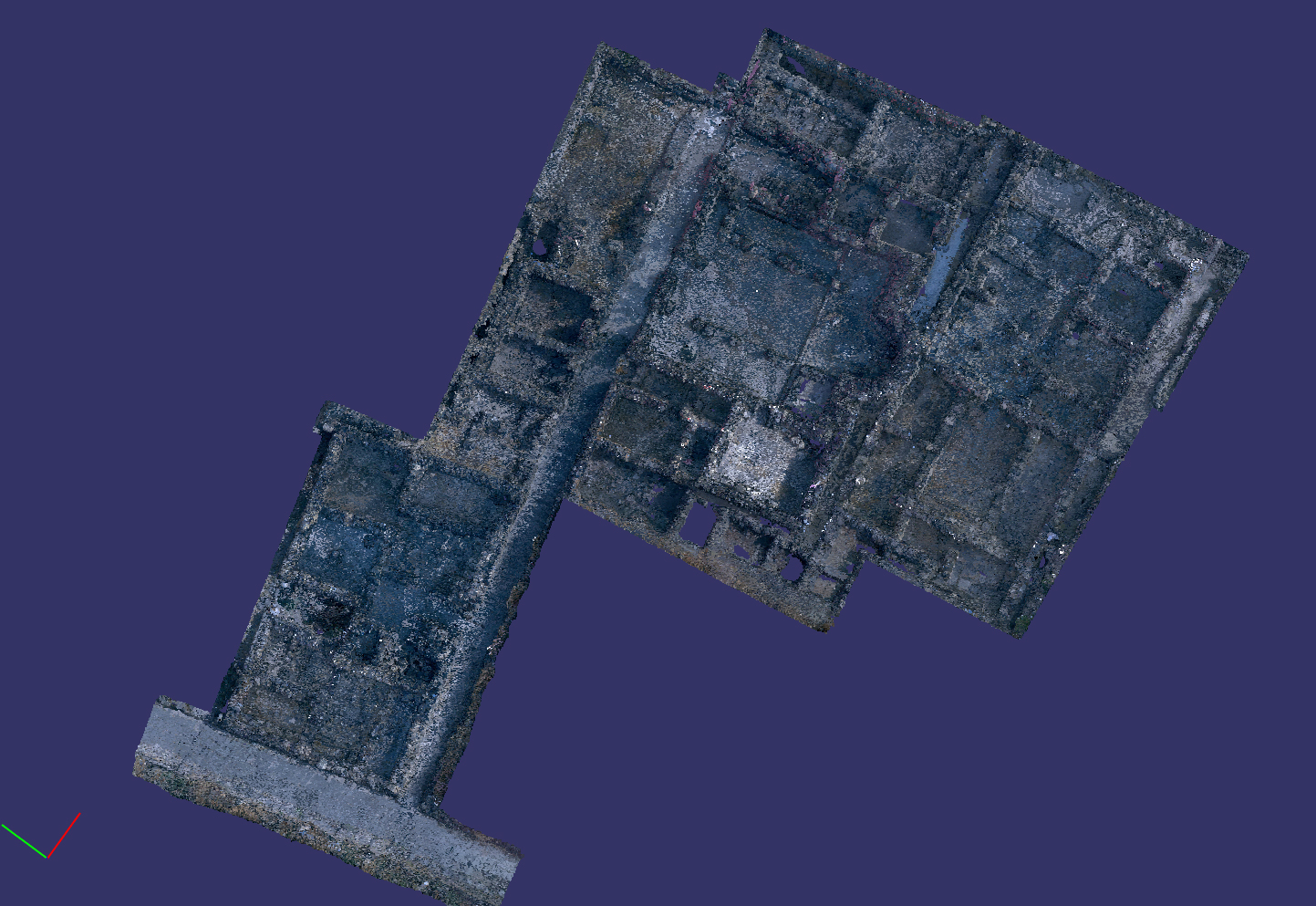
I then spent several days cropping and cleaning up the point cloud to show only the northeast insulae.

northeast insulae
Northeast insulae

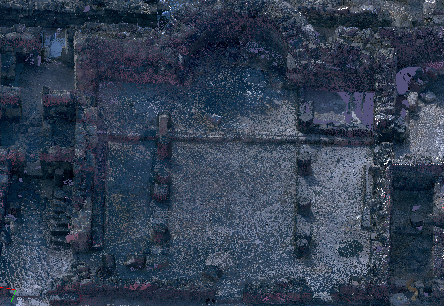
One can orbit and zoom in the model to get at details of the excavation.

Northeast Church
Northeast Church

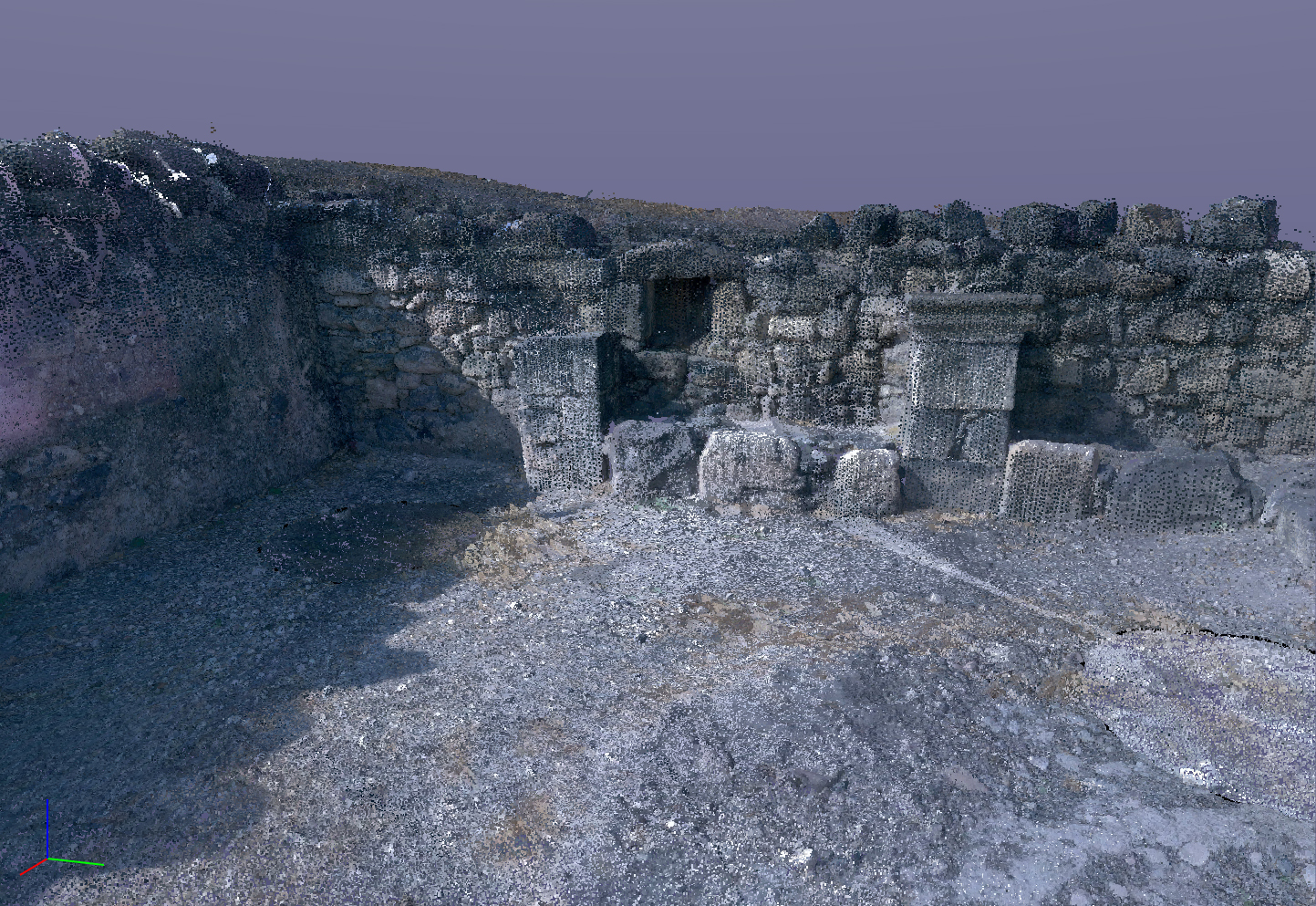
Even fine details are viewable.

South wall and niche from the diakonikon.

There are two ways of building 3D models that we use on the excavation. These examples are made using the lidar methodology. Lidar, which stands for Light Detection and Ranging, is a remote-sensing method that uses light in the form of a pulsed laser to measure ranges (variable distances) to an object. These light pulses generate precise, three-dimensional information about the object.

The second method is photogrammetry. Photogrammetry is the science and technology of obtaining reliable information about physical objects and the environment through the process of recording, measuring and interpreting photographic images. It extracts three-dimensional measurements from two-dimensional data (i.e. images); for example, the distance between two points that lie on a plane parallel to the photographic image plane can be determined by measuring their distance on the image.

Here are two examples of each, the first produced with lidar and the second produced with photogrammetry.

Libar model of the House of Tyche
Lidar of the House of Tyche
Photogrammetry of the House of Tyche

The lidar model moves more easily into CAD applications

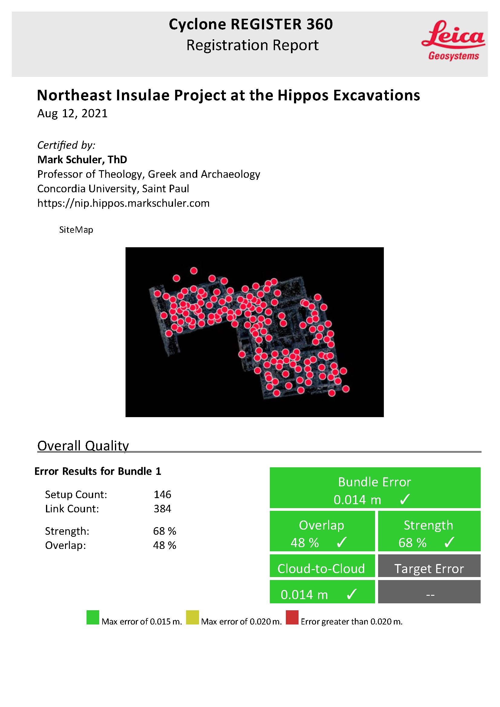
141 scan worlds are used to create the lidar model.

Scan worlds

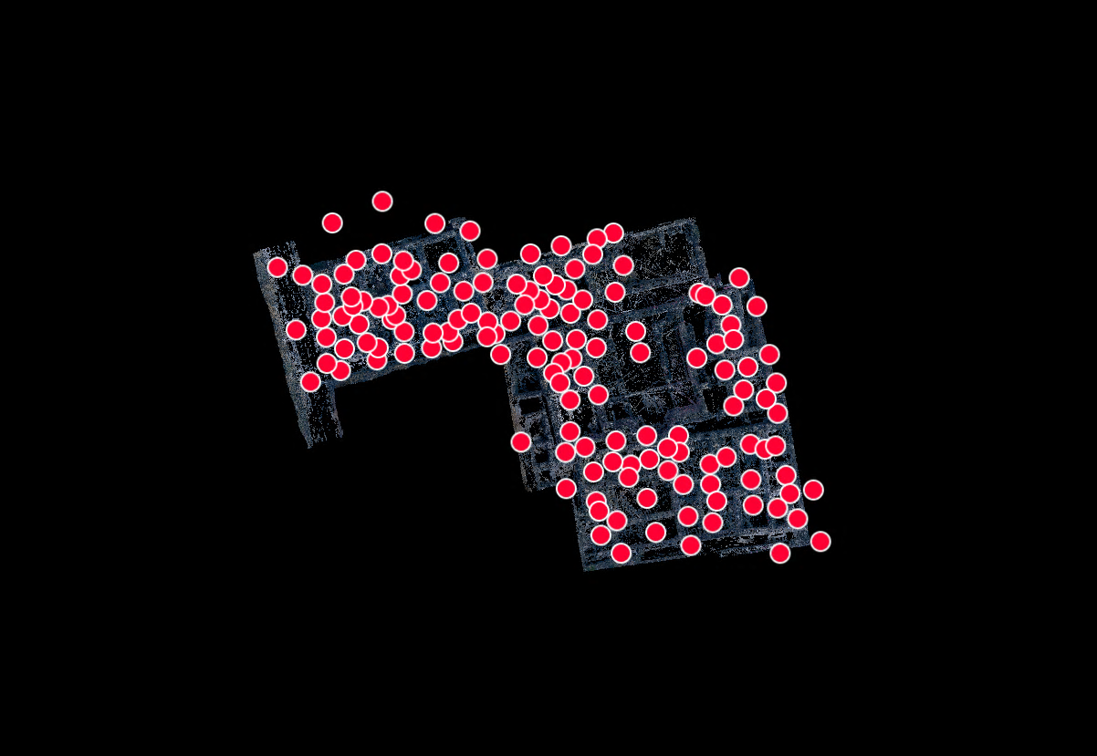
The registration report attests to the reliability of the end products.

Related Posts

The Churches at Umm al-Jimal (el-Jimal)

Research Phase /

The Churches at Umm al-Jimal (el-Jimal)

Sabbatical /

Extended tour with labels

Work at the Albright concludes

Research Phase /

Work at the Albright concludes

‹ History of the Excavation › Lidar-based model

Partners

Open Heritage
IAA

Research services


Back to Top

© Northeast Insulae Project 2025


Cookie Policy
Privacy Policy

Manage Cookie Consent
We use cookies to optimize our website and our service.
Functional Always active
The technical storage or access is strictly necessary for the legitimate purpose of enabling the use of a specific service explicitly requested by the subscriber or user, or for the sole purpose of carrying out the transmission of a communication over an electronic communications network.
Preferences
The technical storage or access is necessary for the legitimate purpose of storing preferences that are not requested by the subscriber or user.
Statistics
The technical storage or access that is used exclusively for statistical purposes. The technical storage or access that is used exclusively for anonymous statistical purposes. Without a subpoena, voluntary compliance on the part of your Internet Service Provider, or additional records from a third party, information stored or retrieved for this purpose alone cannot usually be used to identify you.
Marketing
The technical storage or access is required to create user profiles to send advertising, or to track the user on a website or across several websites for similar marketing purposes.
Manage options Manage services Manage {vendor_count} vendors Read more about these purposes
Preferences
{title} {title} {title}